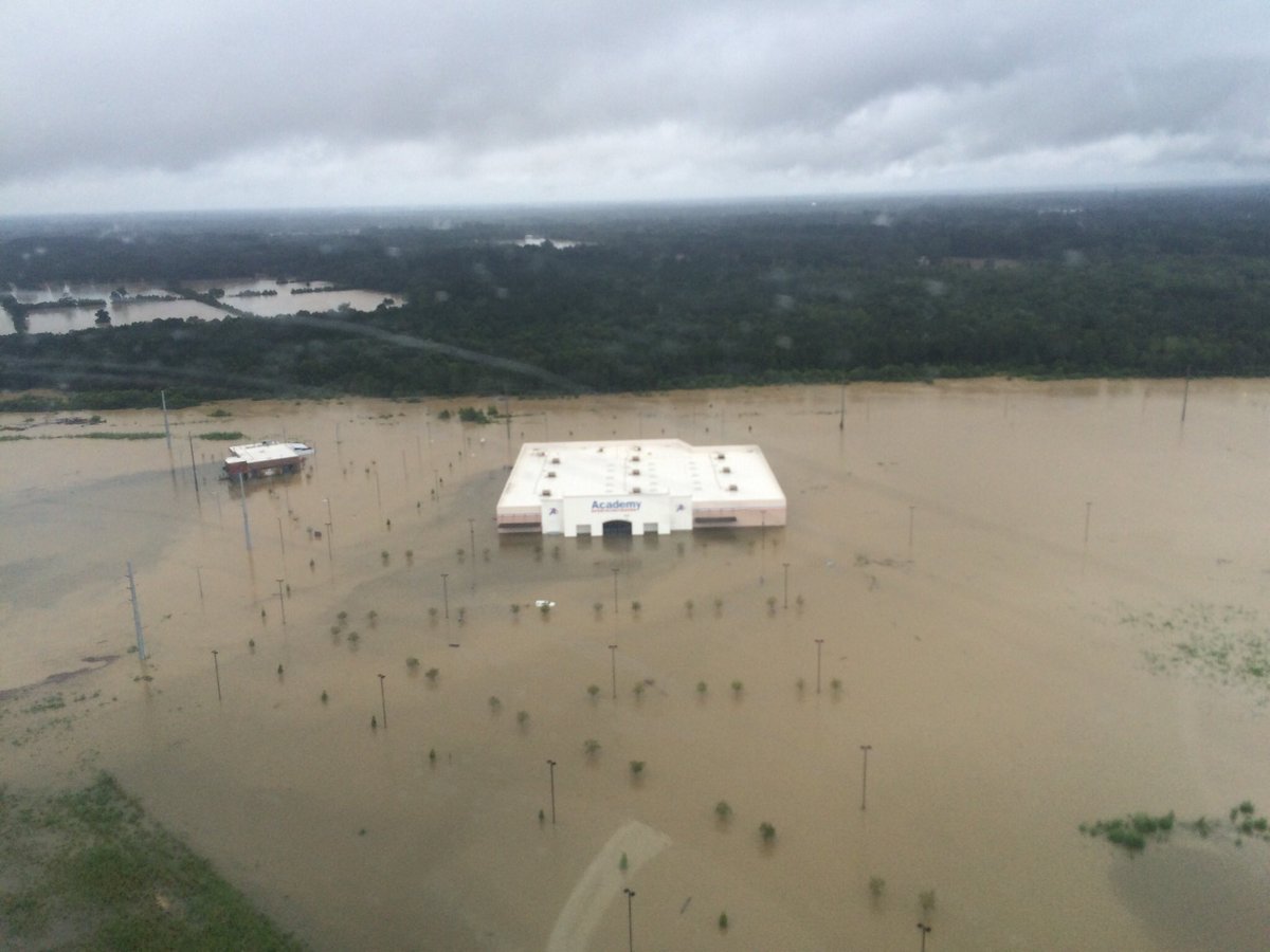
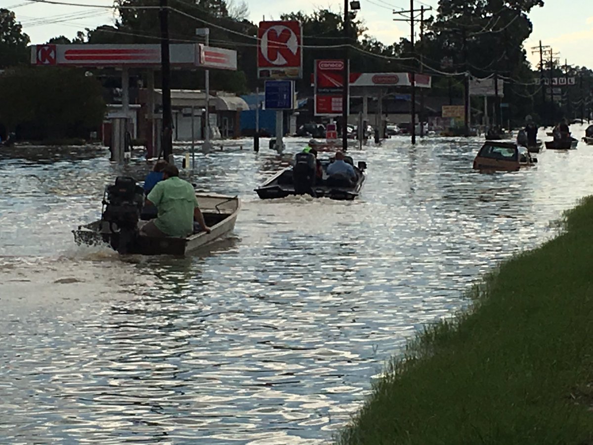
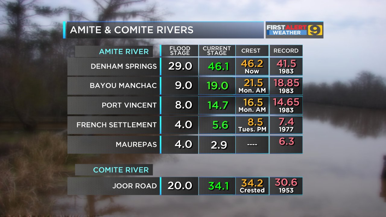
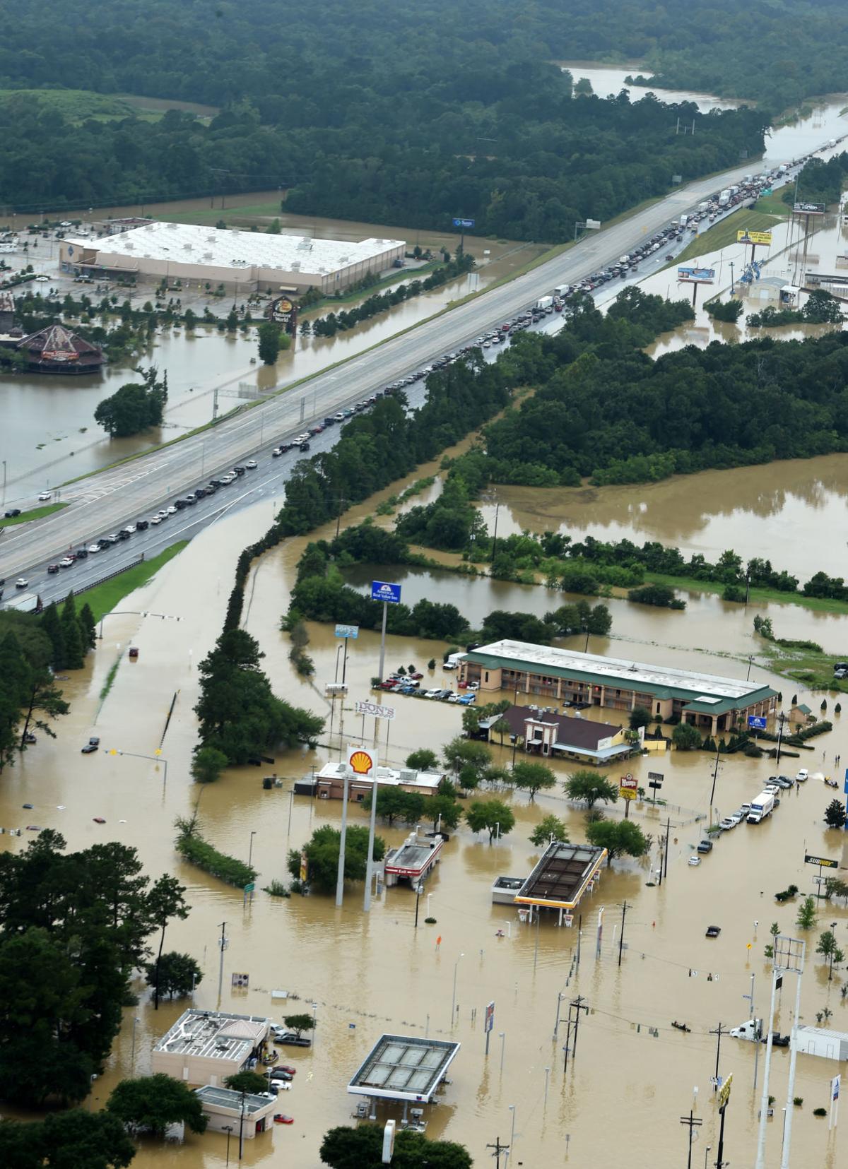
A large portion of Baton Rouge is literally underwater. Denham Springs, Walker, and surrounding areas are hard hit as well. I-12 is closed in both directions from Airline Highway in Baton Rouge to Covington. Portions of I-10 are closed. Hundreds of motorists are trapped and spent the night on the interstate. The city received over 20 inches of rain and now everything is backing up. Areas that didn't flood in 1983 or during Hurricane Andrew are now flooded. Some gauges are no longer able to give readings as they are underwater. There have been thousands of calls for help as people are trapped by flood waters. AT&T is NOT working down there although Verizon is. Here are some useful links.
Check status of interstates and highways.
Watch WAFB live coverage
This TD thread is beating the rest of the media in getting news out.
 |
| New Walk-On's restaurant at Juban Crossin |
|
|
|
 |
| Florida Blvd |


14 comments:
It was very surprising that areas were hit harder than Katrina. Rain is forecast for the next 10 days for LA and MS so there may be more.
Katrina blew through, no pun intended. This is a sit and soak kind of storm, the worst kind for flooding/flood prone areas.
How does this compare to the Jackson flood of 79?
Only a matter of when the Pearl floods again, not if. And afterwards Jackson will be abandoned as the folly of the levees vs lake debate is laid bare for all to see.
How does this compare to the Jackson flood of 79?
WORSE
It's just as bad or worse.
It really doesn't compare to '79. That was a downriver flood event with time to prepare (to some degree)
The Amite River just east of BR crested nearly 5' above it's record flood level and rose that much in about 24-36hrs. It's all-time record, not just it's flood stage. Records are generally broken by inches, not feet. Some places received over 20" of rain in 24hrs.
In MS, one area received 20" of rain and just 5 miles away received 2". This event just continued (and may continue) to dump rain in the same areas.
'79 was widespread rain over months saturating the basin above Jackson and then having a significant widespread event in the same basin and it just flooded as it went down river. 12"-15" of rain fell over the course of 2 months to generate the flooding, in the current situation in LA, way more rain fell in just a day
Remember we were supposed to get alot of rain here in Jackson over the weekend and didn't. Well, that rain that was supposed to come here stayed down there for several days. 20 inches. 83 flood, Andrew, Gustav didn't do this much damage.
I read the following on an engineering company's facebook page yesterday.
Heavy rain over the past 24-hours (ending at 11AM CDT/16UTC) has caused major flooding in Southern #Louisiana. The average recurrence interval map (top) shows a frequency of this amount of rain at over 500-years. More heavy rain is expected during the next 24 to 48 hours. The bottom map shows the #ARI of the 24-hour forecast rainfall ending at 9UTC (4PM CDT) on August 13, 2016. Areas of southern Louisiana are expected to see up to 1000-year rains on top of what they have already received.
Regardless of event types the scale of BR flooding dwarfs Pearl '79. The "time to prepare" in '79 was only relatively longer and meant you got 5% of your key belongings out versus 0% of everything down in BR.
11:23am
Whut?
Of course the time to prepare was relatively longer. What kind of statement was that supposed to convey?
It does not mean you could not have gotten all of your belongings out. What happened in 1979 was that people did not move their belongings when there was risk of flooding because they hadn't flooded before.
1979's flood is attributed to an already saturated basin receiving 7"-15" of rain over 2 months. Way more than that has falling in LA in 24hrs
You've got your factoids a wee bit screwed up @11:49.
12:02
"Screwed up"
from 11:49 post:
1979's flood is attributed to an already saturated basin receiving 7"-15" of rain over 2 months. Way more than that has falling in LA in 24hrs
From your link:
Heavy rain over the course of the winter of 1978-1979 produced extremely heavy rainfall over the ArkLaMiss region. Areas in the Pearl River basin received nearly 50-150% normal of rainfall, with some areas even higher percentages of normal rainfall for the months leading up to April 1979. Nearly 7-15 inches of rainfall fell between March and early April of 1979, exacerbating very highly saturated soils and rivers in the region.
In fact, your link directly supports what was said @ 11:49.
You must still be thinking relatively.
The '79 flood was preceded by heavy rains over a few months - but the flooding was caused by the area upriver (Neshoba County) received 22" of rain on Monday. By Friday, it was reaching the reservoir. If the folks had been paying attention to what was happening 60 miles north, they could have possibly prepared by getting crap out, but little or nothing could have been done to stop the flooding.
Once it hit the res, the issue was saving the dam - which was in danger of being breeched. Much of the flooding in Jackson was caused by the high water from the discharge backing up through the storm drainage systems, and being caught inside the levee.
As to which one is going to be worse - it depends on whether you house was flooded or is being flooded. Other than that perspective, the total number of structures flooded is going to be massive in LA if this keeps up, and possibly will exceed the JAN numbers. But, when one adds the repeat from '83, and assuming that LA won't see a repeat in the next four years, its going to be close.
Post a Comment